Sleaford Castle

We always like getting out and about with different groups, so we have been having a good time recently by helping students from Carres Grammar School. They have been working on a project examining the history and importance of Sleaford Castle, and how it could be more appropriately used by the town in the future.
History of Sleaford Castle
Sleaford Castle is located near the centre of Sleaford. However if you visit today, you will only see a ruined wall, and humps and bumps in the ground. Alexander, the Bishop of Lincoln, built it in the 1100’s to help protect his estates from the brewing civil war. Matilda was contesting her cousin’s, King Stephen’s, right to the throne. As Alexander supported Matilda’s claim, he was vulnerable to attack.
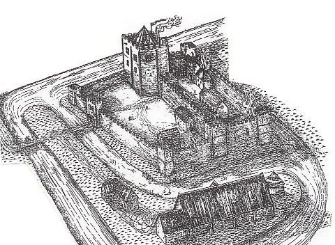
Surrounded by the flat fens, it would have been extremely difficult to launch a surprise attack on the castle, however it also featured a moated area for additional defence, which doubled as a large fish pond. To access the outer bailey, and the manorial barn and agricultural outbuildings, you would have to cross the moat once, however if you wanted to access the main castle on the inner baily, you would have to cross the moat twice, making this a very secure position.
However, for most of its life Sleaford Castle did not see much military action, functioning instead as a manor house. Indeed, Sleaford Castle may have even hosted monarchs, such as King John in 1215 just before his death and possibly even King Henry VIII with his wife Queen Katherine Howard.
Reconstruction drawing by David Taylor
Work by Carres Grammar School
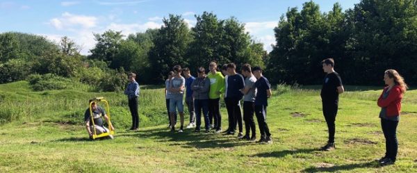
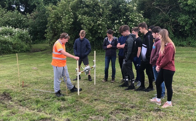
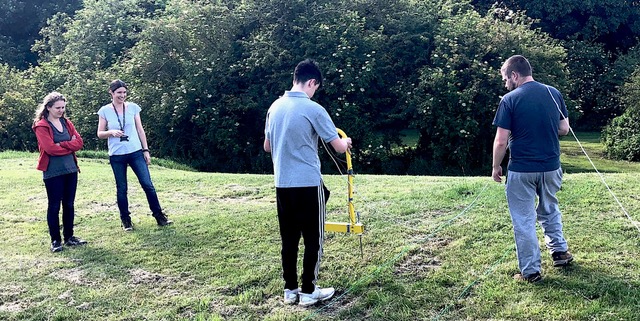
A few years ago, students from Carres Grammar school worked with us to produce a landscape survey of the area. Next, we organised a geophysical survey with the school, which we completed last week. Funded by Historic England, two groups of students got to have a go at completing a resistivity survey (which measures the resistance of the ground to electrical currents) and a magnetometer survey (which measures that magnetic field of the ground), to help us figure out what was beneath the soil.
The area to be surveyed was divided into 30m square grids, and each of these were surveyed in turn. The grids were also recorded using GPS, so that any future projects can see exactly where we did our work. After a brief talk about how the two different techniques functioned, it was time to get to work.
The students took turns in using the two different machines and comparing how easy they were to use. However it was the resistivity meter that produced the best data. They all had a great time and produced some very interesting results! We focused on an area outside of the castle, where it is suspected that the manorial barn had been constructed. The results were clear that there was indeed a building there. The resistivity survey picked up areas of low resistance, which indicated more water in the soil, often caused by digging ditches. These ditches show us where the building walls once stood.
This information will be passed onto the group looking after Sleaford Castle and Historic England. This will help to inform and guide management of the site in the future, thus enabling the students of Carres to have a real impact in how Sleaford Castle is managed in the years to come.


